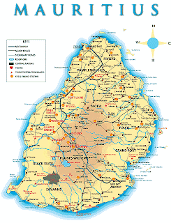
Mauritius is an island nation that is located in the southwestern part of Indian Ocean. It is officially known as Republic of Mauritius. The country is positioned to the east of the Madagascar Islands. The geographical coordinates of the nation are 20°17' South latitude and 57°33' East longitude. The total area covered by the island nation is 2040 square kilometers. In Mauritius map the administrative divisions of the country are marked and the national capital has been highlighted by a red square.
Mauritius Pictures:
 |
| Mauritius Tourism |
 |
| Mauritius Tourism |
Map of Mauritius:
 |
| Satellite map of Mauritius Map |
 |
| Flag of Mauritius |
 |
| seychelles_map |
 |
| Mauritius Map |
 |
| Districts and dependencies of Mauritius |
 |
| Mauritius Map1 |
 |
| Mauritius Map2 |
 |
| Mauritius Map3 |
 |
| Mauritius Map4 |
 |
| Map of Mauritius Island |
 |
| port louis mauritius map |
 |
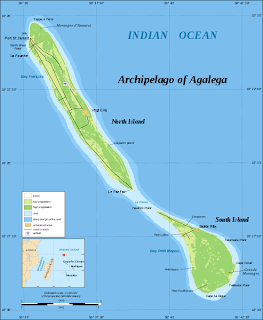
| Map of Agalega Islands |


